Soil moisture and evapotranspiration are two important variables that play a crucial role in the functioning of agricultural ecosystems. Soil moisture is a key determinant of crop growth and productivity, as it affects the availability of water for plant uptake and the rate of water loss through evaporation and transpiration. Evapotranspiration, on the other hand, refers to the total amount of water that is lost to the atmosphere through the combined processes of evaporation from the soil and transpiration from plants.
Together, soil moisture and evapotranspiration are important factors that govern the water balance in agricultural systems and are closely linked to crop yields, water use efficiency, and overall agricultural sustainability. Understanding the dynamics of these variables at high spatial resolution and how they interact with other meteorological and ecological factors is essential for the effective management of agricultural resources and the development of sustainable farming practices.
Accessing high-resolution soil moisture or evapotranspiration datasets can be done by utilizing downscaling techniques. Downscaling of soil moisture and evapotranspiration variables is important for several reasons. At a local scale, understanding the spatial variability of soil moisture and evapotranspiration is crucial for optimizing crop management and irrigation practices. Furthermore, downscaling these variables can help to identify areas of the field that may be suffering from water stress or that may be at risk of waterlogging, which can be addressed through targeted management practices. Additionally, downscaling these variables can inform the development of precision agriculture, which uses high-resolution data to optimize crop yields and reduce waste.
Downscaling of soil moisture or evapotranspiration datasets requires knowledge of crop type classification (Figure 1), some source of coarse resolution of these datasets, and machine learning-based prediction model toolkits. At the moment, we were able to obtain high-resolution soil moisture datasets using SMAP and MODIS satellites’ observations (Figure 2).
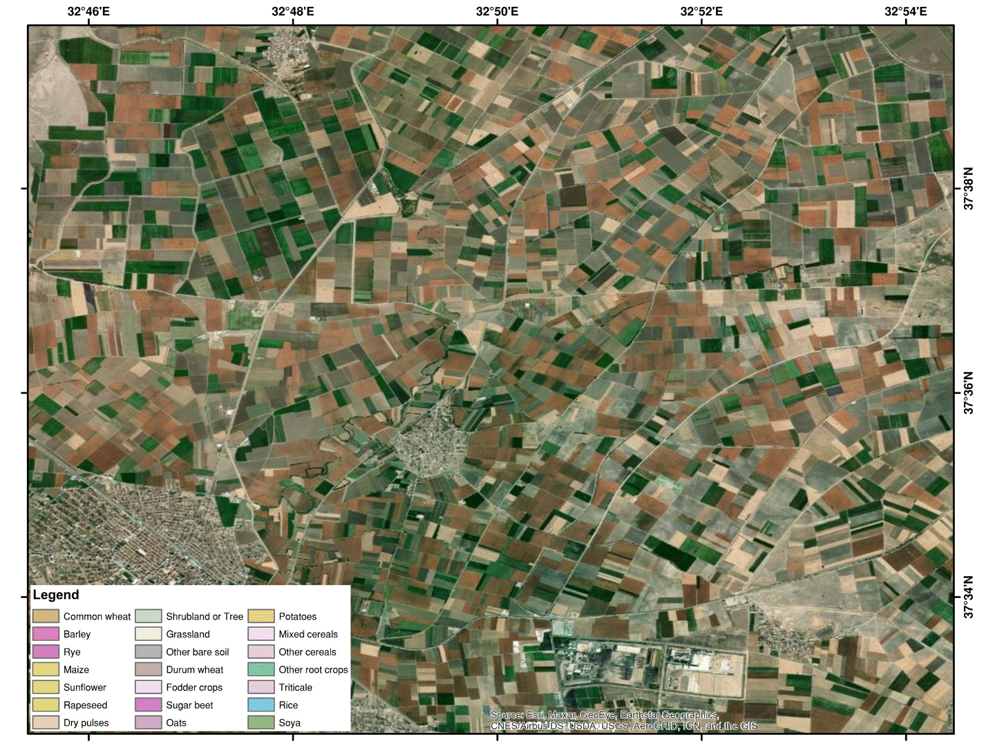
Figure 1: Sample results of crop cover classification
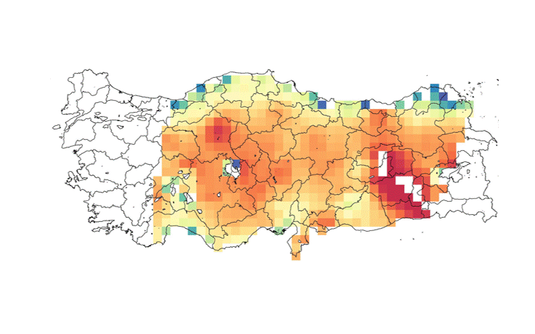
Figure 2: Sample results of downscaling SMAP soil moisture observations using MODIS reflectances
Meanwhile, we are trying to retrieve daily high-resolution evapotranspiration datasets as well as field-scale soil moisture datasets. Hence, interested individuals who are seeking some kind of collaboration in this field, are invited to contact me personally for further discussions.